
Walkers may be wondering what we are doing alongside the public footpath which runs to the west of Halswell House. As most followers of Halswell’s progress know, we are always trying to reinstate the park to its original design and purpose of the 1750’s, when Sir Charles Kemeys-Tynte, gentleman landscape architect, designed the Mill Wood, the Park, and the Follies.
Originally, the so-called West Wood, which runs alongside the ha-ha by the public footpath, used to extend into a neat, sharp triangle. You can see this in the map of 1771.
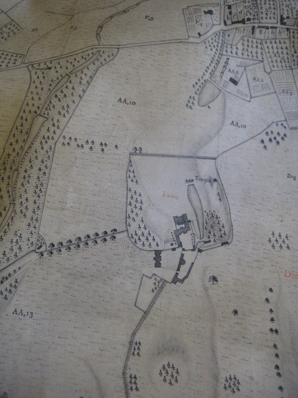
This was also seen in all the Ordnance Survey maps, in the 19th Century. You can see where the private entrance to the House was marked [X] where the public footpath forks off to the right from the access road to the House. We have no evidence of a gate at this points, but the current blue gateposts highlight, where public access is separated from private.
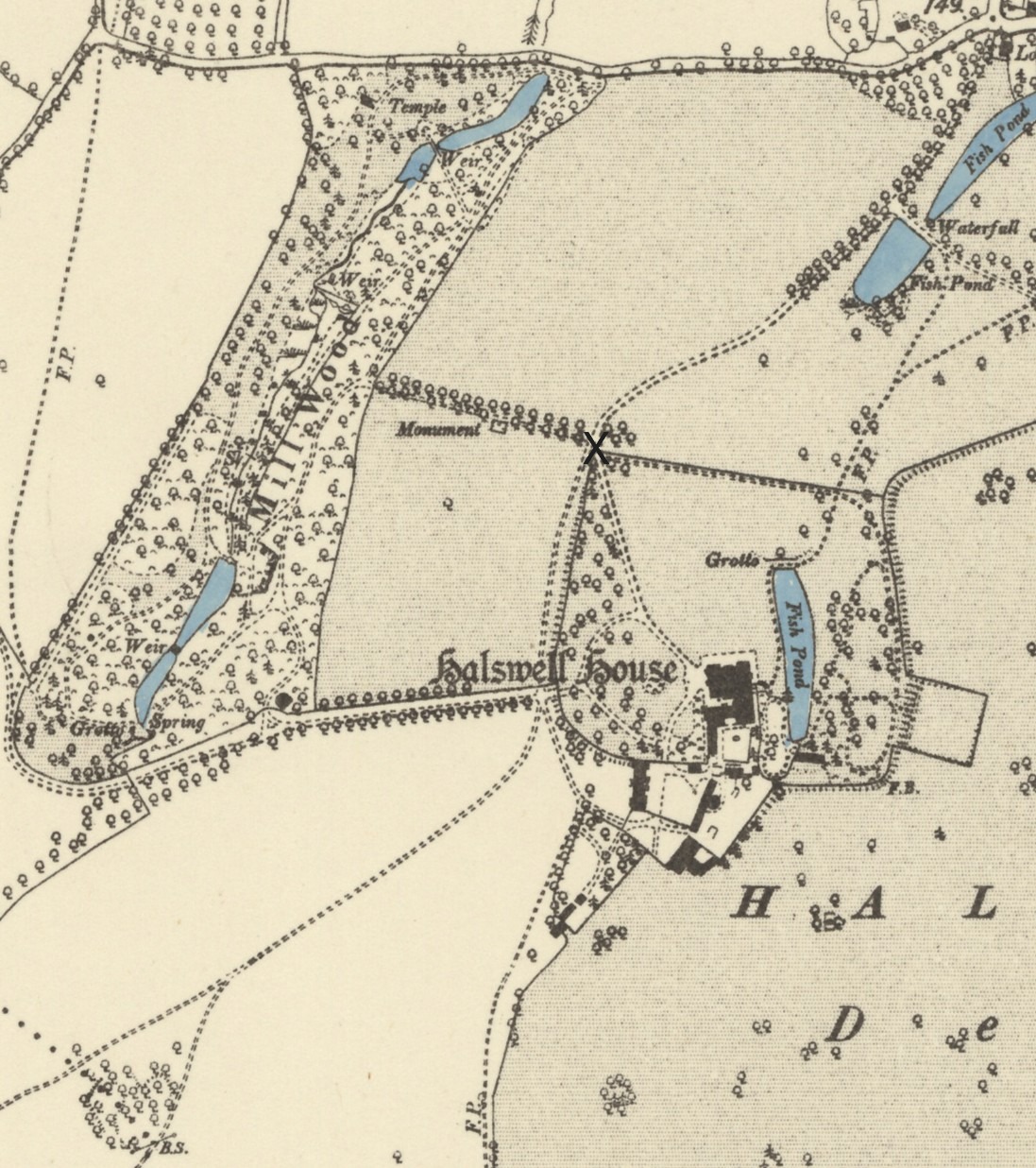
In this map, you can see the fence which runs from the Rotunda to the gate post. This would have kept sheep, to be viewed from the North Rooms of the House, over the new ha-ha, built between 1887 and 1904.
When the Park was broken up and sold off, this triangle from the Rotunda, the small triangle of trees to X, to the ha-ha, was all given over to farmland. So as part of the mass-cutting of trees at Halswell in the 1950’s, this small triangle of West Wood was lost. We are now replanting these, with the original mixture of 120 trees of native woodland. We believe the original ha-ha extended along this side of the triangle, and if our archaeological excavations confirm this and we have the original ha-ha wall, we will reinstate this too.
We will keep you informed of any other progress, but in the meantime we would politely request that walkers respect our privacy and keep to the public footpath, turning right at the blue signs towards the Thickets and returning the same way.
Edward Strachan
19th Jan 2026
